The WYSS Website / Die WYSS Webseiten / Na Leathanaigh WYSS
Landscapes, Towns, Travels, Walks
BERNESE OBERLAND
Hike from First to Faulhorn and Schynige Platte
HÖHENWANDERUNG ZUM FAULHORN IM BERNER OBERLAND
SIÚLÓID GO DTÍ AN FAULHORN INSNA SLÉIBHTE ALPA BEIRNEACHA
Pictures / Bilder / Pictiúir: © by René WYSS (copies only for private use)
Alternative:
A Three-Day Walk from the Reichenbach Falls to Rosenlaui, then from the pass Grosse Scheidegg by way of First to the Faulhorn and from there to the Schynige PlatteThis is about the most popular panoramic walk in the Bernese Alps, and although it is taken by many folk in the summer and fall, both Swiss and foreign lovers of the Alps, and thus fairly busy on some days, it can be highly recommended. It offers no particular technical difficulties, but as always in the mountains, you must be properly equipped and proceed with some care. Walking boots with good soles as well as the usual clothes (windbreaker, a warm sweater just in case) are part of the outfitas well as some food and drink. You may get very thirsty on a sunny day. There are, however, two inns on your way where you can have refreshments and even full meals All in all, you do not need a very heavy rucksack.
You can do this hike as a day tour. Take the cable railway from Grindelwald to First as early in the morning as possible, both because the hike is quite a long one and you want to catch a train at Schynige Platte by six o'clock at the latest.You can also do the walk the other way round.
If you can afford to take more time, you may want to walk from the famous Reichenbach Falls by the side of the stream to Rosenlaui on the first day and then take the bus to Grosse Scheidegg (change at Schwarzwaldalp where you may decide to jump one bus and eat ice-cream in the garden while enjoying the scenery.
You will find the Wetterhorn Hotel situated right on the pass. You will love the stillness that reigns when the last day tourists have left. You will find a simple bed in a pleasant, clean room and will most likely have your evening meal in the hotel restaurant.During the high season it is advisable to book accommodation some days beforehand.
The panorama from the Grosse Scheidegg is impressive but only a foretaste of what still awaits you. When you look north, you can see the Schwarzhorn better than from anywhere else. To the south the view is somewhat impaired by the nearness of the pass to the Wetterhorn.
The walk from Grosse Scheidegg to First is as flat and straight as anything in the Bernese Alps at an altitude of 2000 metres. It can also be undertaken by people who are not very fit but still want to enjoy the mountain scenery.
Overview
Walking Time: First - Faulhorn - Schynige Platte: 5 hours 15 minutes
Overnight stay:
First, Restaurant and Dormitory, 2167 m; Hotel Faulhorn, 2680 m; Männdlenen, 2344 m; Hote Schynige Platte, 1987 m.Maps of the Swiss Ordinance Survey (Landeskarte der Schweiz des Bundesamts für Landestopographie:
No. 1229 Grindelwald, 1228 Lauterbrunnen at the scale of 1:25,000 or No. 254 Interlaken / 254 T Interlaken with routes.Description of the Hike from First to Faulhorn and Schynige Platte
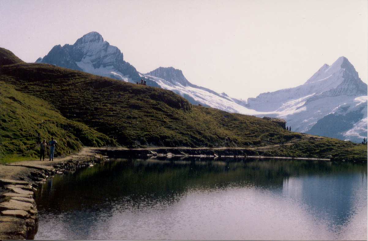
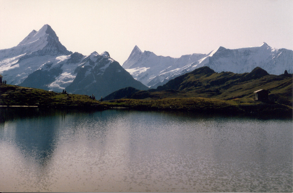
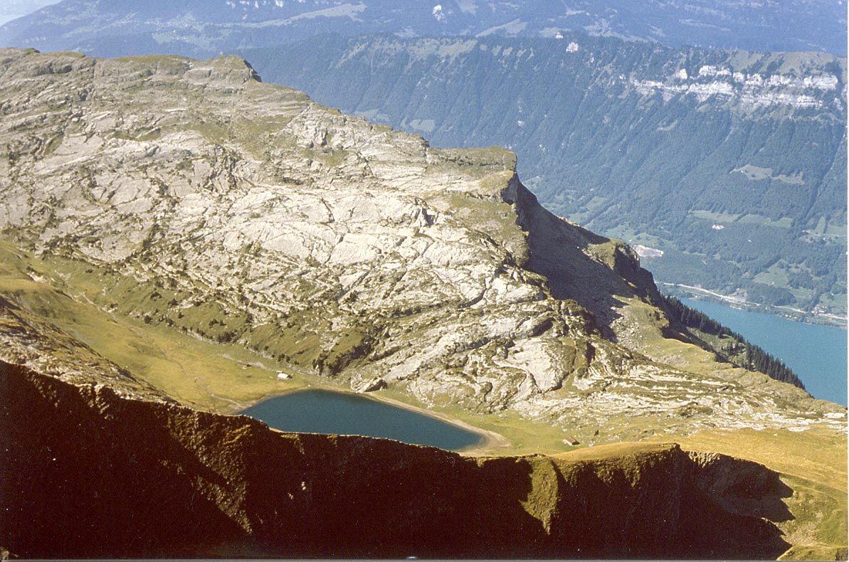
The first stretch of the path takes us from First to Bachsee, a lovely mountain lake. This is a path that tourists walk in their summer shoes. It is also convenient for prams and wheelchairs. The panorama of the snow-capped mountains is enriched by the lake, in which they are sometimes perfectly mirrored.
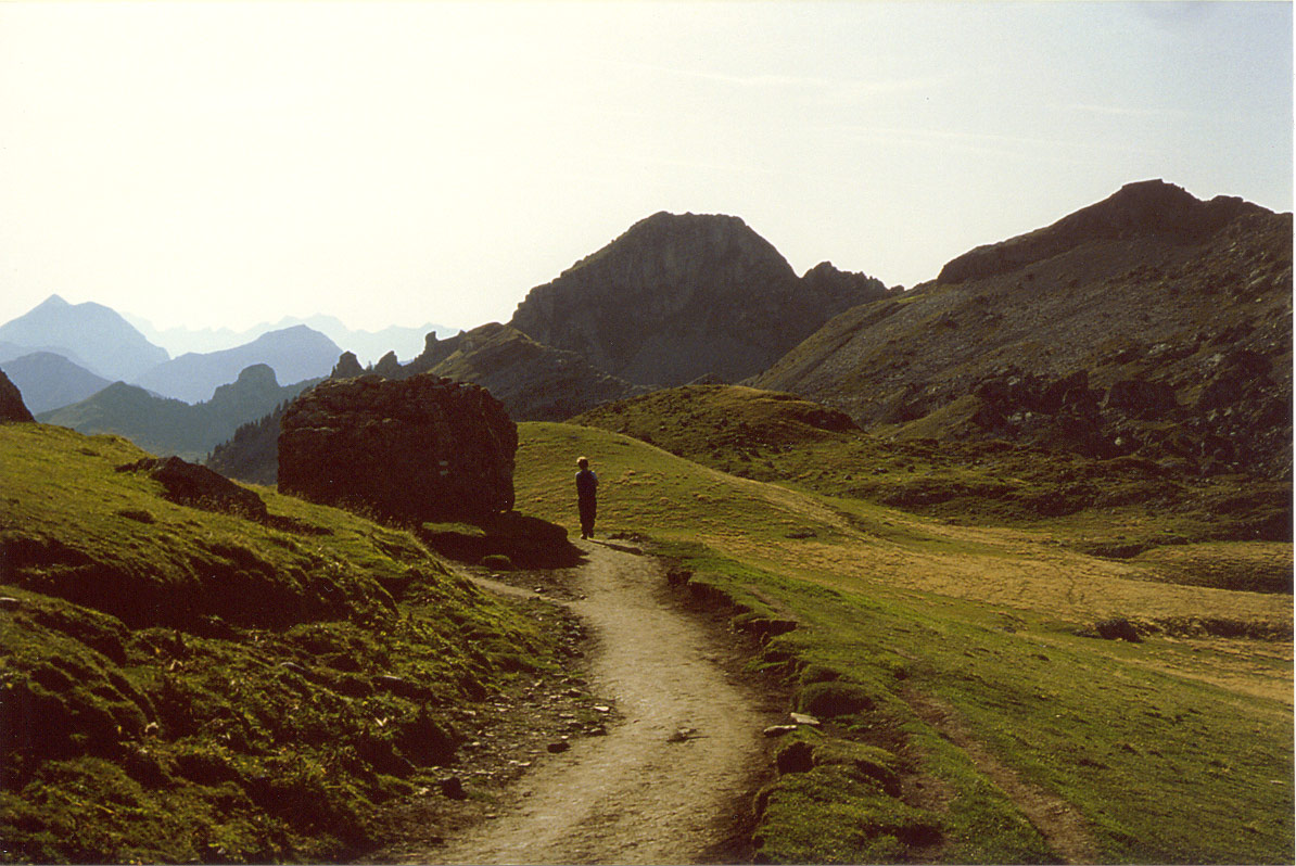
We leave the mass of tourists behind as we reach the upper end of the lake. The path now begins to rise more sharply though it is still fairly broad. We carry on in the shadow of the Rötihorn for a while (Reeti) on the map till we come to a gap. There we turn right and tackle the final ascent to the top of the Faulhorn. The serpentines rise steeply, but they look more forbidding than they are. Moreover, the hotel greets with the promise of food and drink, and maybe a bed for the night. Not only is still one of the very highest-lying hotels but it is very old: it was built in 1843. If you can arrange to stay there for the night, you should do so. You can sleep in the dormitory or, better still, in one of the hotel rooms. The rooms are small, and the beds rather short, but you will feel cozy, and the atmosphere is unique. You can relax over a game of cards in the restaurant and then have dinner at very reasonable prices. The bill of fare is limited, but the food is good.
If the weather is as fine as in these pictures, you may want to get up early in the morning to see the sun rise over the mountains.
The hike goes on for fully three hours when we leave the Faulhorn. You continue to command a view of the highest mountains for the larger part of the walk. After passing by the quaint old restaurant and hostel at Männdlenen, however, the path turns north. It is sometimes slippery here, and some care is advisable. We can see the north side of the Faulhorn from here, and the hotel looks like an eyrie. Then we look do to the secluded Sägistal, a dale which offers good grazing to the neat that spend the summer here. As the path continues the view broadens again, and after a further half hour we may be a little weary and looking forward to a rest. Another drink from the flask will help us to get over the last bit, and then we stand at the upper station of the Schynige Platte Railway. If we are in no hurry, we may decide to stay and visit the Alpine Garden on the next day, a botanical garden where we can see the indgenous flora of the Bernese Oberland.
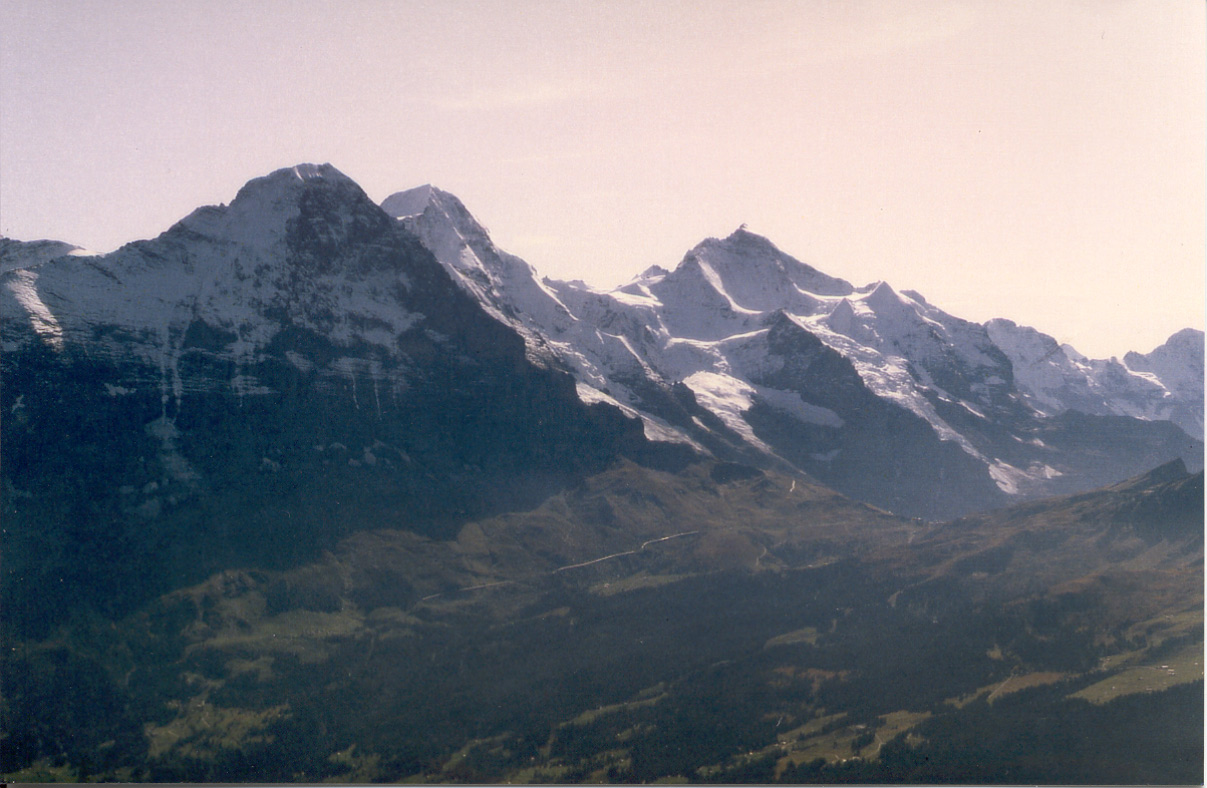
Wetterhorn (3701 m), Berglistock (3656 m) and the twins Lauteraarhorn (4042 m) and Schreckhorn (4078 m)
(from left to right)The Wetterhorn is Grindelwald's landmark. The mountain has three peaks, all about the same height.
Lauteraarhorn and Schreckhorn are the two summits in the Bernese Oberland that are exclusively on Bernese territory.
The glacier that flows down between these mountains is called Oberer Grindelwaldgletscher.
Lauteraarhorn (4042 m), Schreckhorn (4078 m), Finsteraarhorn (4274 m) and Grosses Fiescherhorn 4049 m).
The Finsteraarhorn is the highest mountain in the Bernese Alps. It looks slender from here but massive and sublime from other perspectives. The north face of the Fiescherhörner is less noted but quite as forbidding as that of the Eiger.
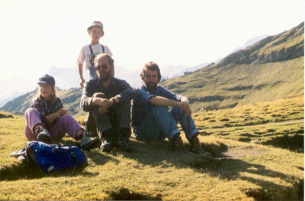
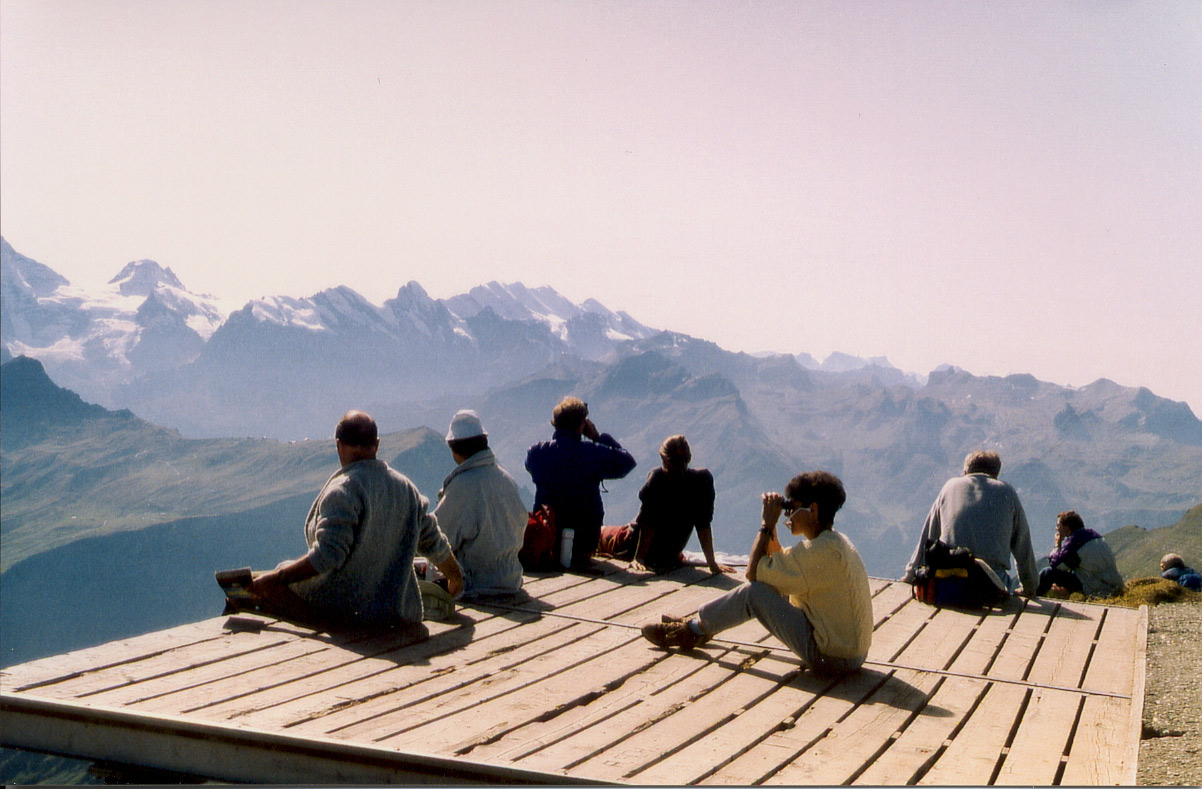
The photos of this group, like the other pictures, were taken in early October 1992. Along with members of the family can be seen Tony Feller (the bloke whose head is not balding).
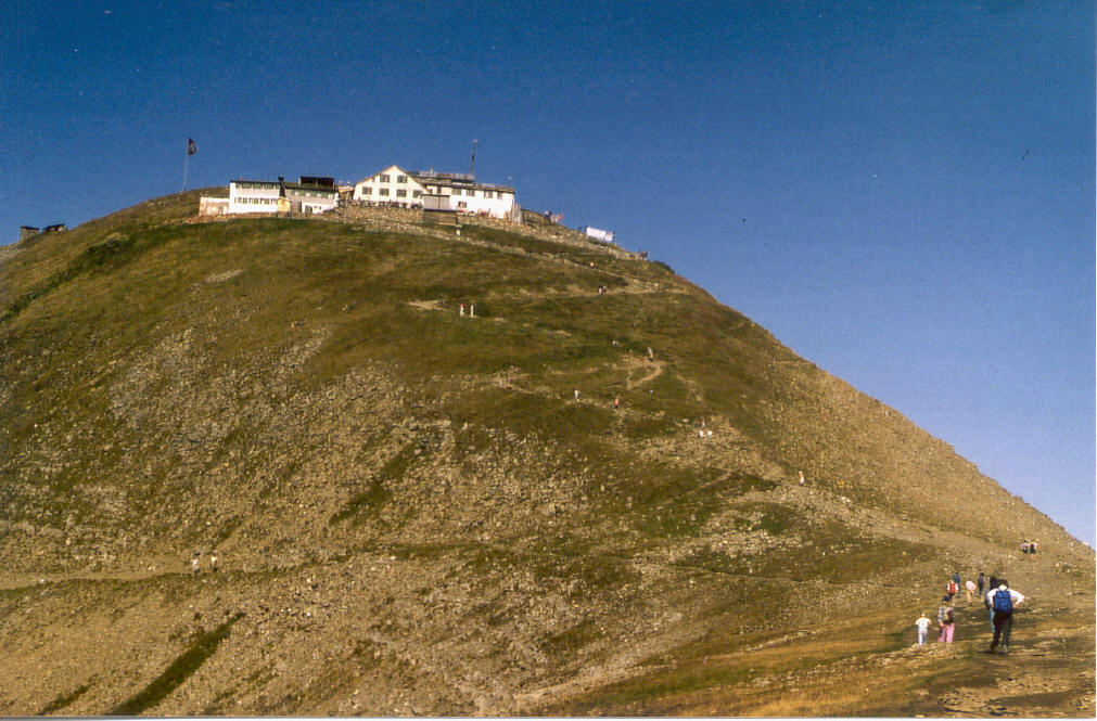
The Faulhorn (2681 m) with its old hotel, as seen from the south.
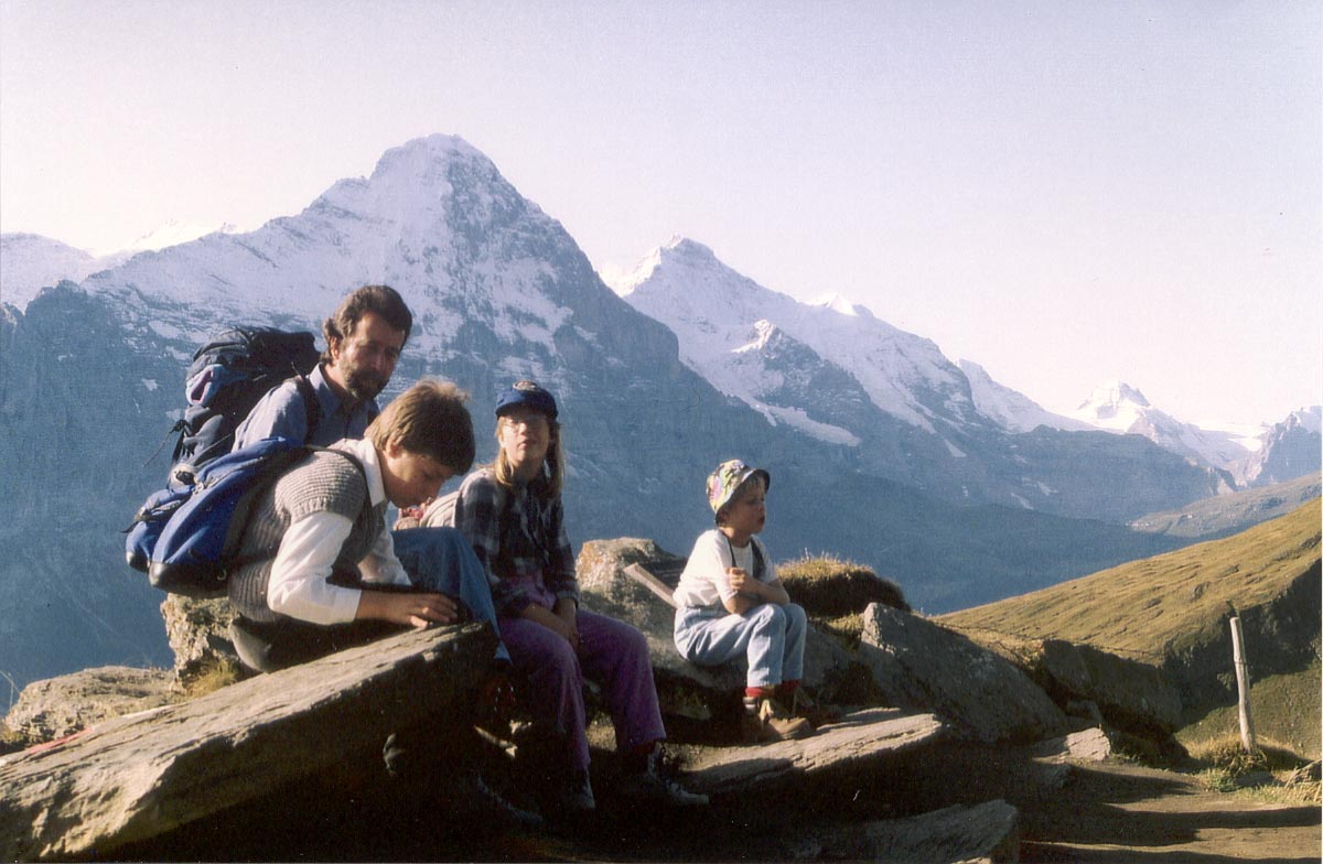
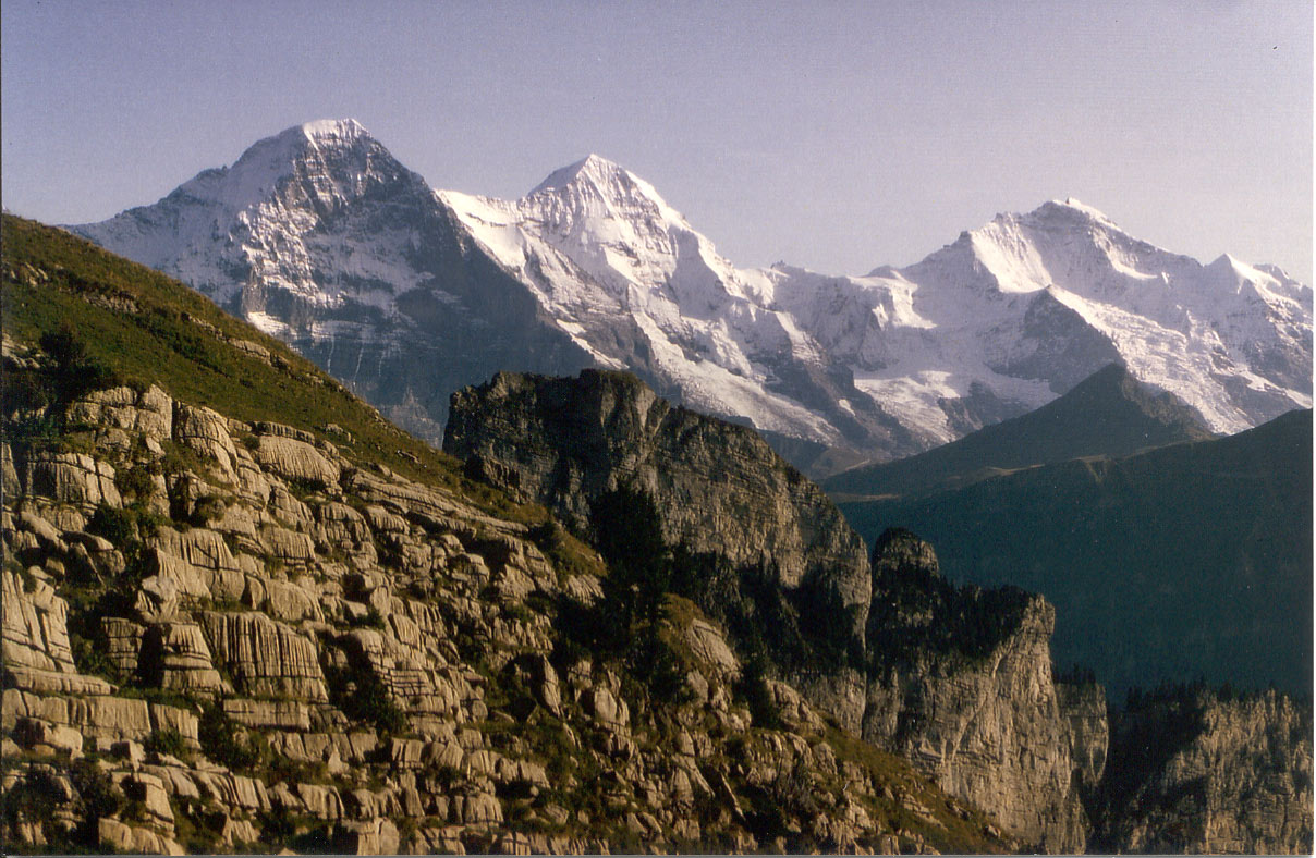
Eiger (3970 m), Mönch (4108 m), Jungfrau (4158 m) and Breithorn (3782 m) as seen from the summit of the Faulhorn.
The gap on the right in the middle ground is the Kleine Scheidegg, which can be reached by rail and is the point of departure for the famous mountain railway to the Jungfraujoch (the saddle between Mönch and Jungfrau, 3454 m).
The Lauberhorn is to the right of the Kleine Scheidegg, at the very edge of the picture. Beyond it can be seen the Breithorn, the mountain that marks the upper end of the Lauterbrunnen Dale.
Tschingelhorn (3577 m), Gspaltenhorn (3437 m), Blümlisalp (3664 m), Wildstrubel (3253 m) and Schwalmern (2777 m).
This is the continuation of the panorama to the right. The Blümlisalp is the broad mountain in the middle of the picture, whereas the Wildstrubel can be found when you go straight up from the back of the head of the lady who is watching through her fieldglasses. Schwalmern is on the right, before the drop to Lake Thun.
To the left of the Eiger, the other mountains that we have shown on the pictures from the Bachsee can, of course, still be seen. Indeed, the panorama stretches even much further to the east.
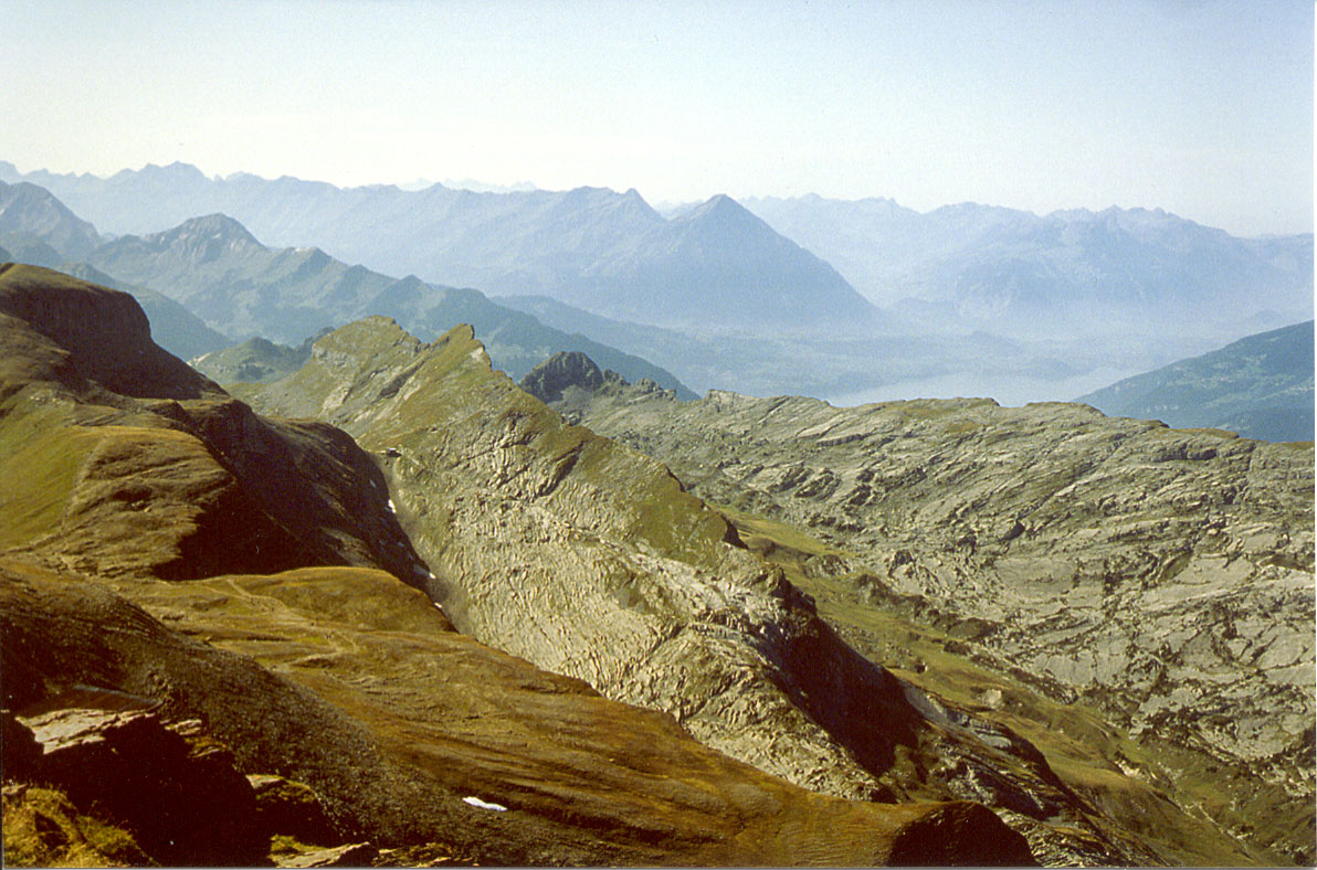
Morgenberghorn, the Niesen Ridge and Lake Thun to the west north west
Looking north, we behold two lakes. The small one is Sägistalsee at the lower end of Sägistal, a secluded glen grazed by cows during the summer.We shall pass by the glen as we continue our walk.
The big lake (on the right) is Lake Brienz.
Having walked in the shadow of the Sägisen ridge, Albert comes out at the upper end of Sägistal into more open ground again, with the grey face of the Laucherhorn right ahead of him.
The Schwalmern can be seen in the haze on the far left.
Towards the end of the walk Eiger, Mönch and Jungfrau reappear from a slightly different angle.
The dark-grey peak below the Jungfrau is the Lauberhorn.
As we are travelling home on the train from Schynige Platte to Wilderswil, we may catch a glimpse of the Jungfrau from the train as on this photo.
The Schynige Platte Bahn is a rack railway and connects Schynige Platte to Wilderswil down in the valley, where you can change to a train of BOB, the railway line that runs between Interlaken and both Grindelwald and Lauterbrunnen.